Welcome to Ichnosat
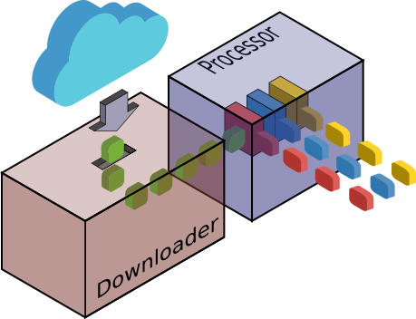
Ichnosat is an Open Source plugin based platform able to download and process EO satellite data. It is written in Python and C++, has been designed and developed by Raffaele Bua for Sardegna Clima Onlus NPO. Downloads and Processes are multithreaded and schedulable. The Platform is configurable and the processor is extendible via C++ plugins.
Docker containers are included in the package, facilitating the installation and running.
Source code is released under the MIT license and it is available on GitHub.
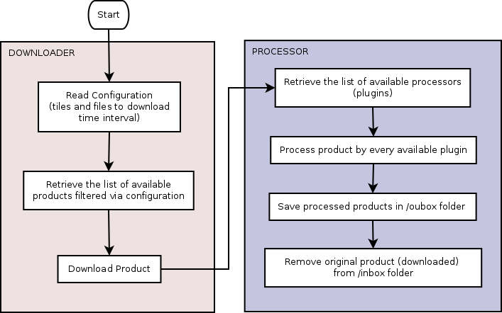
The downloader gets automatically products from Sentinel-2 on AWS portal. Such a downloader is multithreaded and can be fully customized in terms of AOI (Area of Interest) and Products Sensing Time.
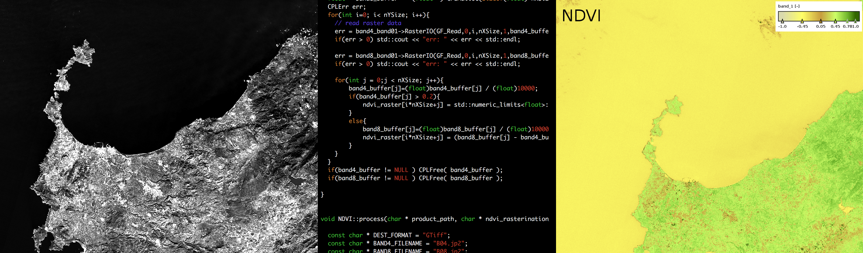
The processor gets products from the downloader and processes products via C++ plugins. Current version contains a single plugin able to extract from Sentinel-2 data the NDVI exploiting GDAL library.
Ichnosat processor is multithreaded, extendible via C++ plugins and customizable.
- Cross-platform support
- Ichnosat Platform provides the Docker containers
- Downloader
- Get Sentinel-2 data from Sentinel-2 on AWS
- Customizable features:
- Tiles to download (UTM-MGRS Tile-ID)
- Files to download for each tile (Image files and/or metadata)
- Dates interval (Sensing time)
- Number of parallel downloads at the same time
- Processor
- Plugin based: the processors are extendible C++ Shared Libraries
- Customizable features:
- Number of parallel processings at the same time
- Ichnosat Platform
- Automatic plugin compilation
- HTTP APIs to manage the system
- Customizable cron for scheduling run
- Graphical User Interface (Web based)
- Run Downloader and Processor
- Show product lists
- Compile plugins
- Manage Database
- Testing
- Unit tests run at Platform start-up
- API-documentation
- Autogenerated API-documentation via Sphinx from comments in the code (PEP 257 Convention)